


OHIO — The National Weather Service in Wilmington, Ohio, is warning residents to prepare for a wintry stretch of weather that could bring accumulating snow followed by bitter cold temperatures.
Forecasters say multiple storm systems are likely to move through the region beginning Thursday night, with snowfall continuing into Friday morning and returning again on Saturday.
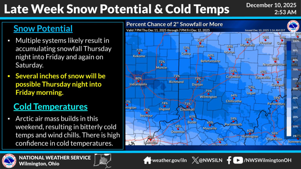
Several inches of accumulation are possible Thursday night into Friday, with the highest chances focused across central and western parts of Ohio. Forecast maps show many areas with a greater than 60% chance of receiving at least two inches of snow during that period.
Once the snow systems move through, an Arctic air mass is expected to settle over the area for the weekend. This will bring sharply colder temperatures and wind chills that could drop well below freezing. The National Weather Service notes there is high confidence that the cold blast will produce bitter wind chills.
Drivers are advised to monitor changing road conditions and plan for possible travel impacts Thursday night through Friday morning. Residents should also prepare for dangerously cold weather by limiting time outdoors and ensuring pets and vulnerable individuals have adequate warmth.


