


IOWA — A Severe Thunderstorm Watch remains in effect for parts of eastern Iowa until 10 p.m. CDT Wednesday as scattered thunderstorms are expected to develop through the afternoon and evening.
The watch includes Allamakee, Cedar, Clayton, Clinton, Delaware, Dubuque, Jackson, Jones, Muscatine and Scott counties.
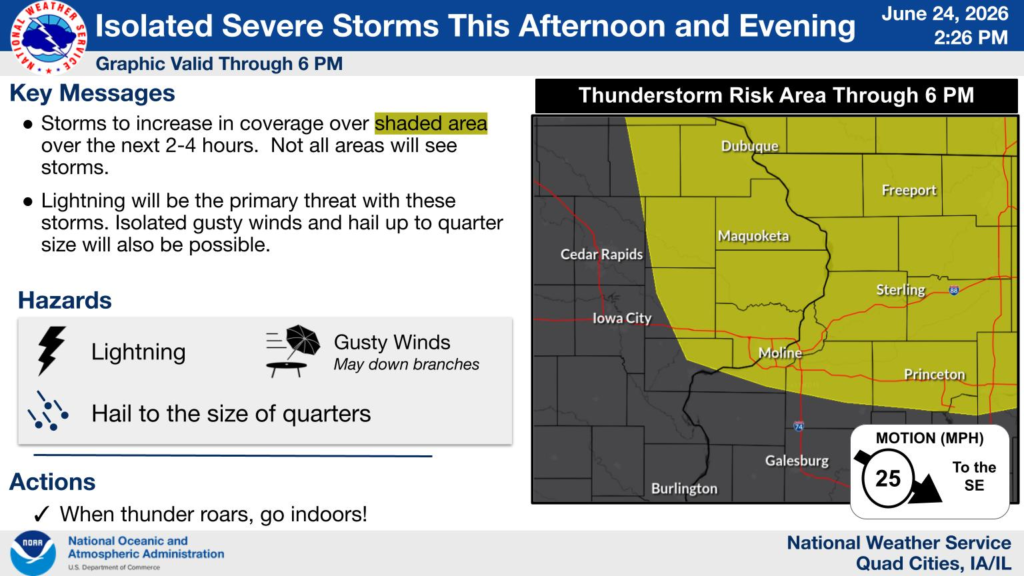
According to the National Weather Service, scattered thunderstorms are expected to develop during the afternoon and continue into the evening. While not every location will experience severe weather, a few storms could become strong to locally severe.
The primary hazards include frequent lightning, localized heavy downpours and gusty winds. The strongest storms may produce damaging wind gusts capable of downing tree limbs and hail up to the size of quarters.
Residents should also be alert for brief periods of heavy rainfall that could reduce visibility and create hazardous travel conditions.
People in the watch area are encouraged to move indoors if thunder is heard, use caution while driving during heavy rain and continue monitoring forecasts in case additional watches or warnings are issued.


