


ILLINOIS — A Severe Thunderstorm Watch remains in effect for parts of northern Illinois until 10 p.m. CDT Wednesday as scattered thunderstorms are expected to develop through the afternoon and evening.
The watch includes Boone, Bureau, Carroll, DeKalb, Grundy, Henry, Jo Daviess, Kane, Kendall, Lake, La Salle, Lee, Livingston, McHenry, Ogle, Putnam, Rock Island, Stephenson, Whiteside and Winnebago counties.
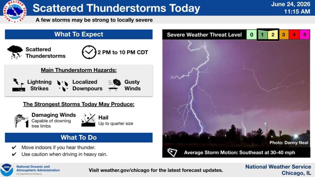
According to the National Weather Service in Chicago, scattered thunderstorms are expected to develop between 2 p.m. and 10 p.m. While not every location will see severe weather, a few storms could become strong to locally severe.
The primary hazards include frequent lightning, localized heavy downpours and gusty winds. The strongest storms may produce damaging wind gusts capable of downing tree limbs and hail up to the size of quarters.
The overall severe weather threat for northern Illinois is rated at Level 2 out of 5, or a slight risk.
Residents are encouraged to move indoors when thunder is heard and use caution when driving through heavy rain. Officials advise monitoring the latest forecasts throughout the day in case additional watches or warnings are issued.


