


MINNESOTA — The National Weather Service’s Storm Prediction Center has issued a Severe Thunderstorm Watch for 26 Minnesota counties until 8 p.m. CDT Friday as strong to severe thunderstorms are expected to develop late this afternoon and continue into the evening.
The watch includes Anoka, Becker, Benton, Carver, Chisago, Dakota, Douglas, Goodhue, Hennepin, Isanti, Kanabec, Kandiyohi, McLeod, Meeker, Mille Lacs, Morrison, Otter Tail, Pope, Ramsey, Scott, Sherburne, Stearns, Todd, Wadena, Washington and Wright counties.
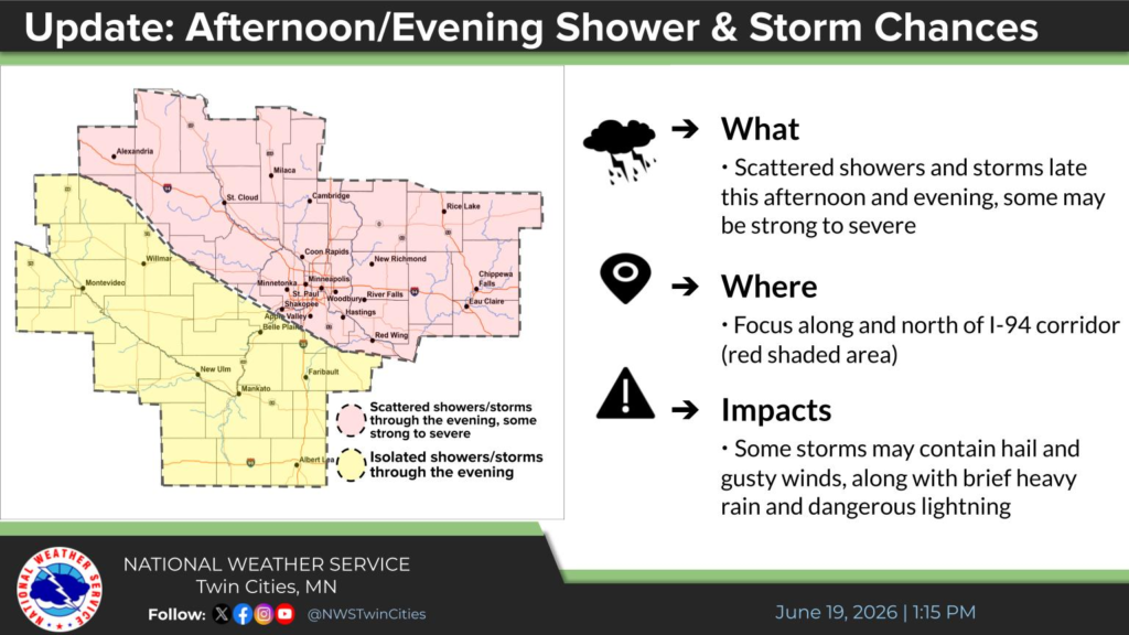
Forecasters say scattered showers and thunderstorms are expected to develop, with the primary area of concern along and north of the Interstate 94 corridor. The strongest storms could produce large hail and damaging wind gusts.
Residents in the watch area are encouraged to closely monitor weather conditions and be prepared to seek shelter if severe thunderstorm warnings are issued. Those with outdoor plans should be prepared for rapidly changing weather through Friday evening.


