


ALABAMA — A Flood Watch remains in effect across much of Alabama through Friday, with forecasters warning that additional heavy rainfall could lead to flash flooding in low-lying and flood-prone areas.
The greatest concern stretches across southern, central and southeastern Alabama, where repeated rounds of thunderstorms are expected to continue through the day and into the evening. Counties included in the Flood Watch include Mobile, Baldwin, Escambia, Covington, Butler, Montgomery, Lee, Houston, Coffee, Dale and dozens of others.
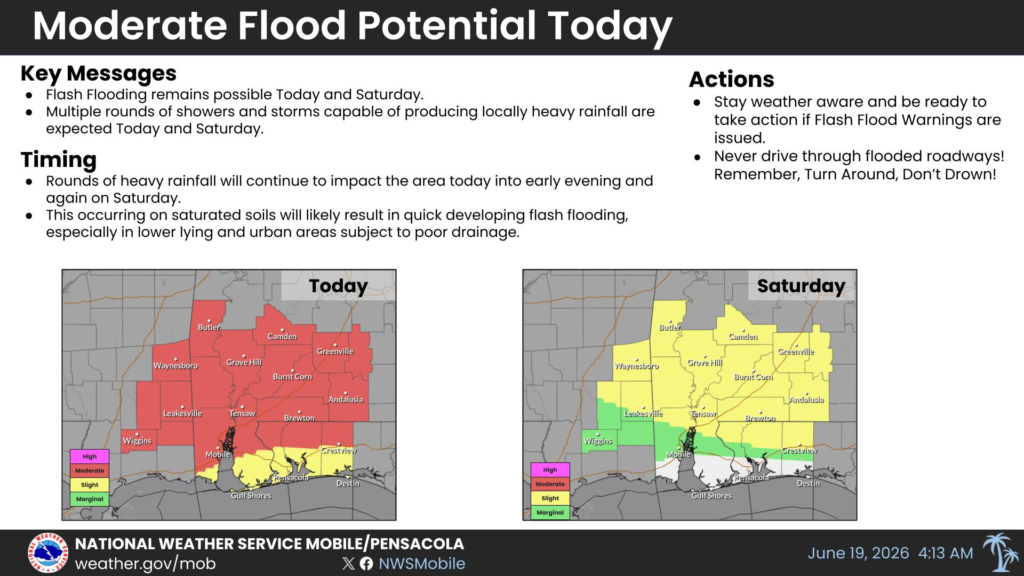
The National Weather Service said saturated ground from previous rainfall will make it easier for additional storms to produce flash flooding. Excessive runoff could cause rivers, creeks and streams to overflow, while flooding is also possible on roads, in urban areas and in locations with poor drainage.
In southwest Alabama, some areas have already received several inches of rain, with additional rainfall expected before the system moves out. Across southeast Alabama, forecasters are calling for another 1 to 3 inches of rain, with isolated locations potentially receiving more than 5 inches where thunderstorms repeatedly move over the same areas.
In addition to the flooding threat, portions of Alabama remain under a marginal risk for severe thunderstorms Friday. Isolated storms could produce damaging wind gusts and hail.
Residents are urged to stay weather aware, monitor the latest forecasts and be prepared to act if Flash Flood Warnings are issued. Officials also remind motorists never to drive through flooded roadways, following the safety message: “Turn Around, Don’t Drown.”


