



KENTUCKY — The National Weather Service has issued a Flood Watch for much of northern and eastern Kentucky beginning late Tuesday night or Wednesday morning and continuing through late Wednesday night as heavy rain and thunderstorms are expected across the region.
Forecasters warned that excessive rainfall could lead to flash flooding, especially in low-lying and flood-prone areas. Creeks, streams and rivers could quickly rise as repeated rounds of storms move over the same locations.
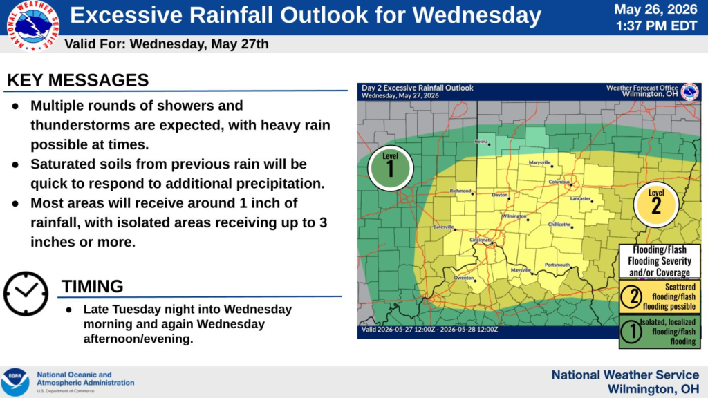
Counties included in the Flood Watch include Boone, Bracken, Campbell, Carroll, Gallatin, Grant, Kenton, Lewis, Mason, Owen, Pendleton and Robertson counties in northern Kentucky. Additional watches were issued for Bath, Fleming, Montgomery and Rowan counties in eastern Kentucky, as well as Boyd, Carter and Greenup counties in northeastern Kentucky.
The National Weather Service said widespread rainfall totals of around 1 inch are expected in some areas, with localized totals between 2 and 3 inches possible. Forecasters warned that already saturated ground conditions from recent rain could worsen flooding concerns.
Meteorologists said several rounds of showers and thunderstorms are expected as a warm front lifts north through the Ohio Valley. In eastern Kentucky, officials warned torrential downpours could develop near a slow-moving boundary Wednesday.
Residents living in flood-prone areas are urged to closely monitor forecasts and be prepared to act if flood warnings are issued.