



INDIANA — The National Weather Service has issued a Flood Watch for parts of southeastern Indiana beginning late Tuesday night and continuing through Wednesday night as heavy rain and thunderstorms are expected to move across the region.
Forecasters warned that excessive rainfall could lead to flash flooding in low-lying and flood-prone areas, with rivers, creeks and streams possibly rising quickly.
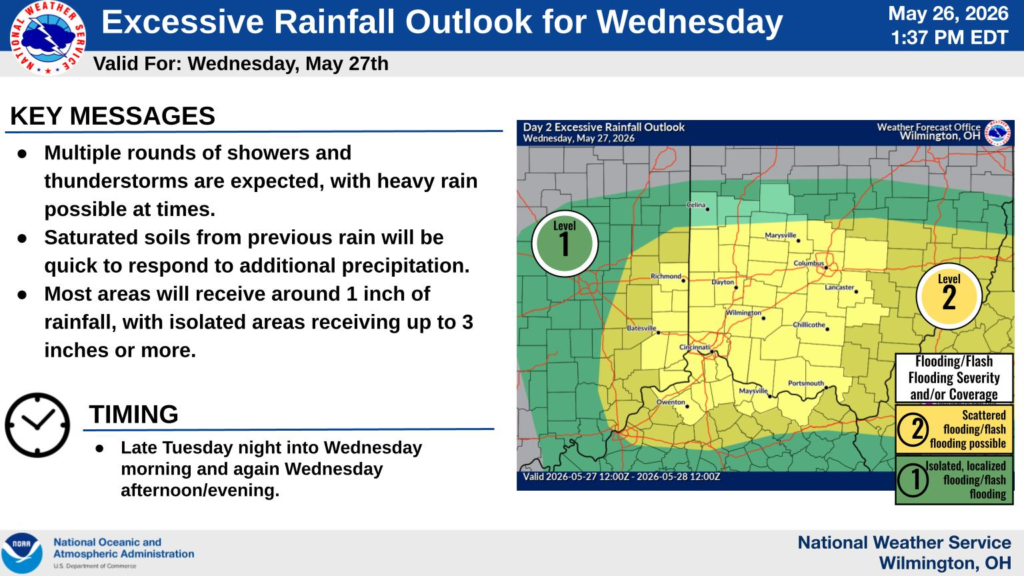
Indiana counties included in the watch are Dearborn, Fayette, Franklin, Ohio, Ripley, Switzerland, Union and Wayne counties.
The National Weather Service office in Wilmington, Ohio, said several rounds of showers and thunderstorms are expected as a warm front lifts north across the Ohio Valley. Widespread rainfall totals of around 1 inch are forecast, with isolated areas potentially receiving 2 to 3 inches of rain.
Additional Flood Watches were also issued for Jefferson County in southeastern Indiana by the National Weather Service office in Louisville. That watch begins Wednesday morning and continues through late Wednesday night. Forecasters there warned that repeated storms moving over the same areas could produce localized rainfall totals between 1.5 and 2.5 inches.
Officials said saturated ground conditions from recent rainfall could increase the risk of flash flooding.
Residents are urged to monitor forecasts and be prepared to take action if flood warnings are issued.