


ALABAMA — Multiple school districts across Alabama are monitoring a significant severe weather threat that could lead to closures or schedule changes on Wednesday, as forecasters warn of potentially dangerous storm conditions.
The National Weather Service’s Storm Prediction Center has placed much of the state under a heightened risk for severe weather, including an enhanced risk across central and western Alabama. The outlook indicates that strong to severe thunderstorms are expected to develop Wednesday afternoon and continue into the evening.
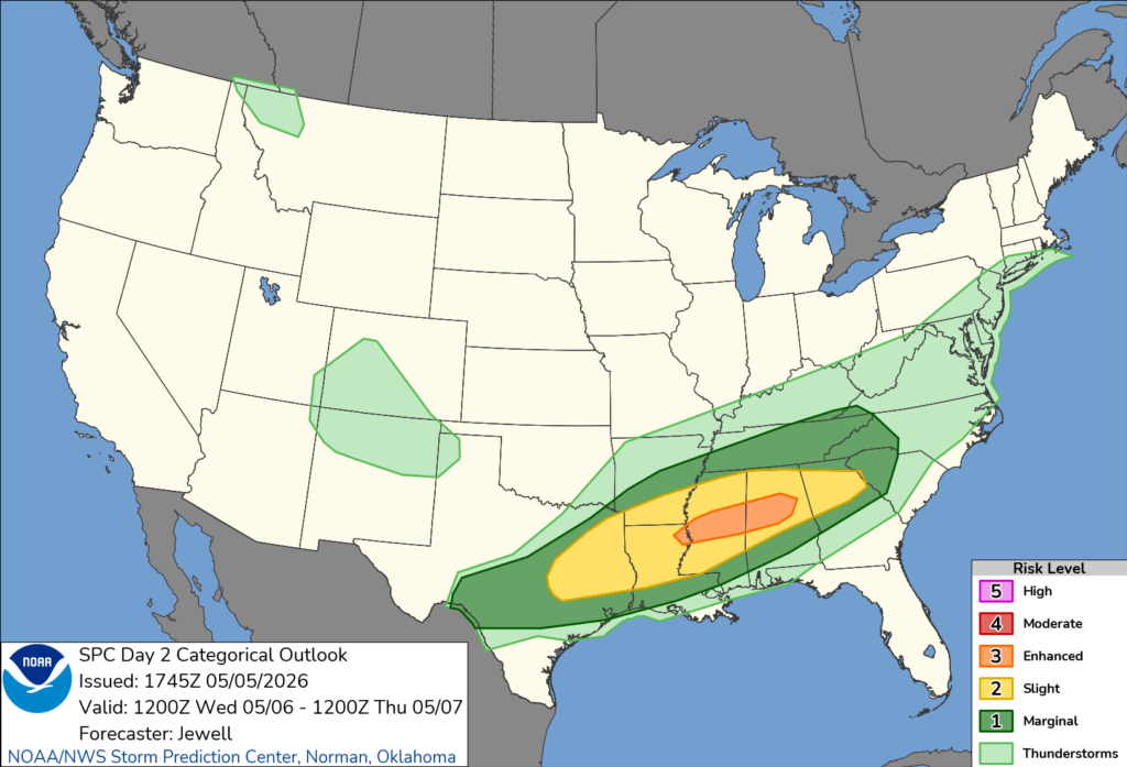
Forecasters say the storms could produce tornadoes, damaging wind gusts, and large hail. The Storm Prediction Center specifically noted that tornadoes appear most likely from Mississippi into Alabama, with corridors of damaging winds also possible across the region.
School officials are closely monitoring the forecast as the potential for downed trees, widespread power outages, and flooding could create unsafe conditions for students and staff. Heavy rainfall may lead to high water on roadways, particularly in low-lying and flood-prone areas, which could impact bus routes and travel.
The primary window for severe weather is expected to begin late Wednesday afternoon and continue into the evening hours, coinciding with dismissal times for many schools. Early-day storms are also possible, though the greatest risk is expected later in the day.
District leaders typically weigh factors such as road conditions, power reliability, and overall safety when determining whether to close or delay school operations. Announcements regarding any closures or schedule changes are expected to be made as the forecast becomes clearer.
Residents are encouraged to stay weather-aware and monitor updates from local officials and school districts as conditions develop.


