


LOUISIANA — Multiple school districts across Louisiana are monitoring a developing severe weather threat that could lead to closures or schedule changes on Wednesday, as forecasters warn of dangerous storm conditions across the region.
According to the National Weather Service’s Storm Prediction Center, parts of northern Louisiana are under an enhanced risk for severe thunderstorms, with much of the state included in a broader slight risk area. The storms are expected to develop Wednesday afternoon and continue into the evening hours.
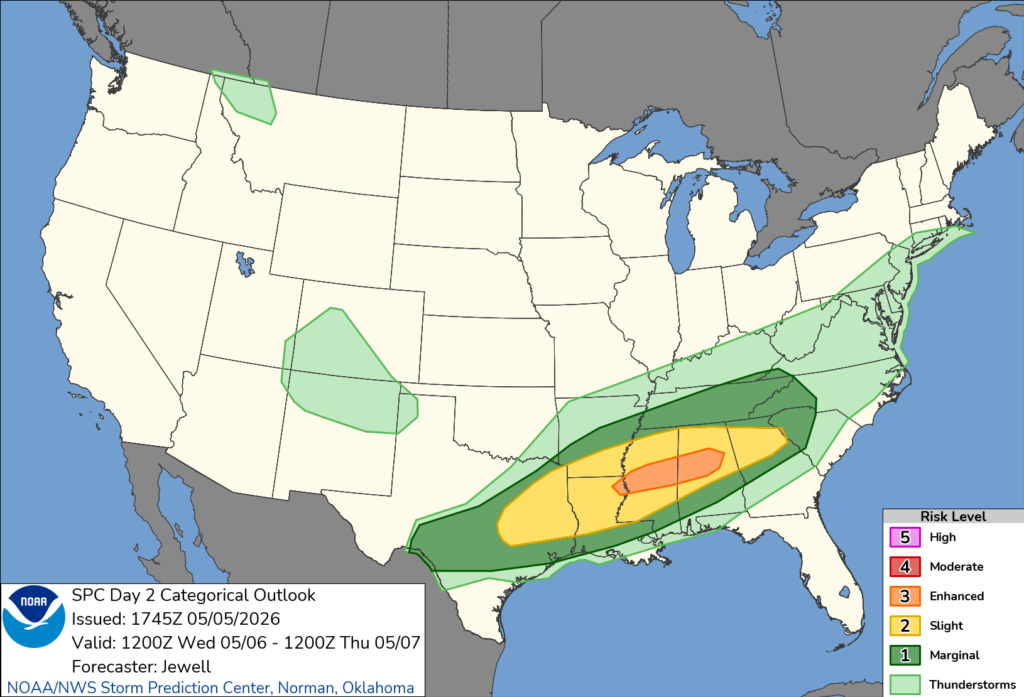
Forecasters say the system could bring tornadoes, damaging wind gusts, and large hail. In addition, heavy rainfall may result in localized flooding, particularly in low-lying areas and locations with poor drainage.
School officials are closely watching the forecast, as conditions such as downed trees, power outages, and flooded roadways could create hazardous travel for students and staff. Bus routes in rural areas may be especially vulnerable to high water and debris, prompting districts to consider closures or delays if conditions worsen.
The Storm Prediction Center noted that scattered severe thunderstorms are expected to form across eastern Texas and spread into Louisiana and the lower Mississippi Valley. Storms may intensify during the late afternoon and evening, increasing the likelihood of severe impacts during dismissal times for some schools.
Strong winds could knock down trees and power lines, potentially leading to widespread outages that may affect school operations.
Parents and students are encouraged to stay informed through local school district announcements and weather updates as the situation develops.


