


INDIANA — Lake-effect snow is expected to continue across parts of northern Indiana through Monday, creating hazardous travel conditions and potentially impacting the Monday morning commute, according to the National Weather Service.
A Winter Weather Advisory remains in effect until 1 p.m. Monday for the following counties:
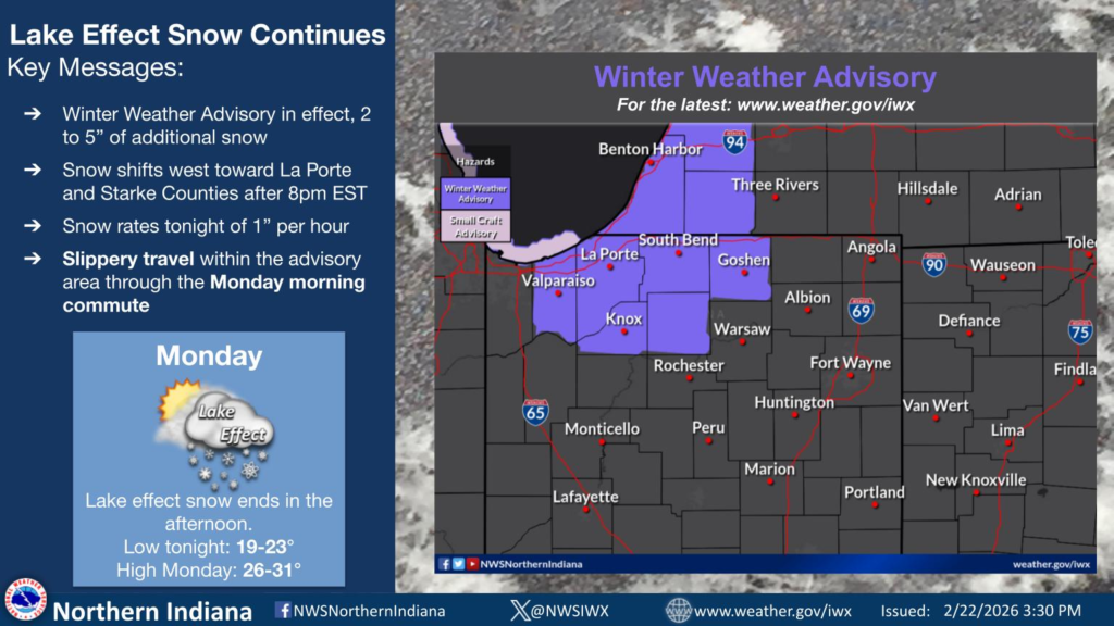
- Northern and Southern La Porte County
- Eastern and Western St. Joseph County
- Marshall County
- Starke County
- Porter County
In Elkhart County, the advisory is in effect until 1 a.m. EST Monday.
Forecasters say additional snow accumulations will generally range from 2 to 5 inches across La Porte and St. Joseph counties, with locally higher totals possible in heavier snow bands.
Marshall and Starke counties could see 2 to 4 inches, while Porter County is expected to receive 2 to 4 inches, especially east of State Road 49 and north of U.S. Route 30. Elkhart County is forecast to pick up an additional 1 to 2 inches, with isolated areas reaching up to 3 inches.
Winds are expected to gust between 25 and 40 mph, particularly near the Lake Michigan shoreline in Porter County. Blowing and drifting snow may further reduce visibility and create slick conditions, especially on bridges and overpasses.
Officials warn that road conditions may vary significantly over short distances due to narrow bands of lake-effect snow. Motorists are urged to slow down and use caution while traveling. The worst conditions are expected Sunday evening through Monday morning.
Drivers can check the latest road conditions by calling 511 or visiting the Indiana Department of Transportation’s traffic information website.


