


GEORGIA — As parts of northeast Georgia continue recovery efforts following last weekend’s Winter Storm Fern, forecasters say another round of winter weather could impact the region late this week.
The National Weather Service office in Peachtree City issued a statement Wednesday afternoon, Jan. 28, indicating that snow is possible across North Georgia from Friday night, Jan. 30, through Saturday night, Jan. 31. Meteorologists say confidence is high that snow will develop somewhere in the region, though uncertainty remains regarding how widespread the snowfall will be and how much accumulation may occur.
According to the National Weather Service, confidence is high that another surge of extreme cold will accompany and follow the storm system, increasing the potential for winter-related impacts. Temperatures on Saturday are expected to remain in the 20s and continue falling throughout the day, which could allow snow to accumulate on roadways and other surfaces.
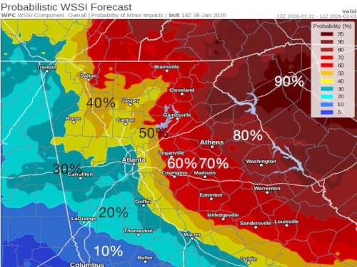
A probability map released by the weather service shows all of northeast Georgia with at least a 50 percent chance of minor snowfall impacts. The highest chances are focused across eastern portions of the region, including Banks, Habersham, Stephens, Franklin, and Hart counties. Hall County is shown with a 60 to 70 percent chance of snowfall-related impacts.
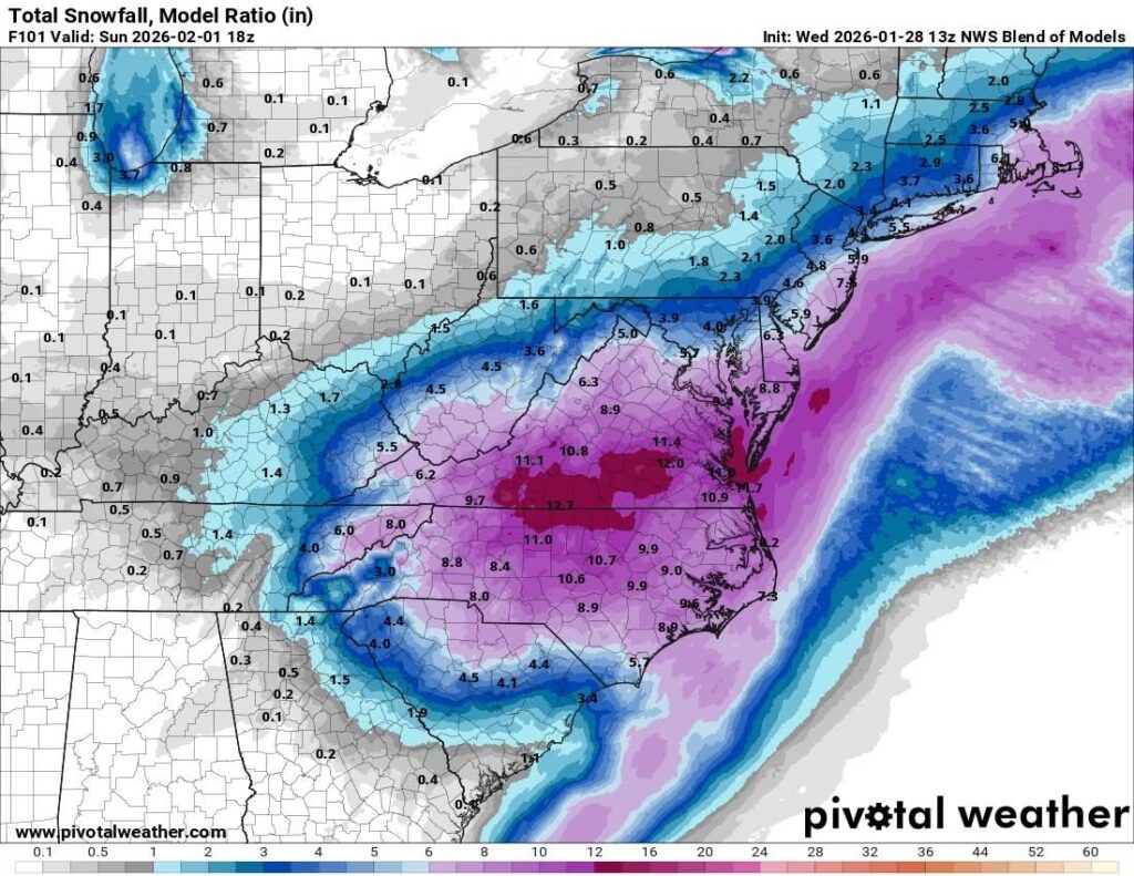
Currently, the National Weather Service National Blend of Models, pictured above, shows measurable snowfall for northeast Georgia.
The National Weather Service says forecasts will continue to be refined throughout the week as the system approaches. Residents are encouraged to closely monitor updates and prepare for the possibility of additional winter weather impacts heading into the weekend.


