


VIRGINIA — Forecasters are monitoring a developing winter weather system that could bring accumulating snow to parts of Virginia and the Mid-Atlantic region late this week into the weekend, though significant uncertainty remains regarding its exact impacts.
According to the National Weather Service, a low pressure system is expected to intensify along the North Carolina coast Friday into Saturday. As the system strengthens, it may track northward and develop into a significant coastal winter storm capable of producing snow across portions of Virginia.
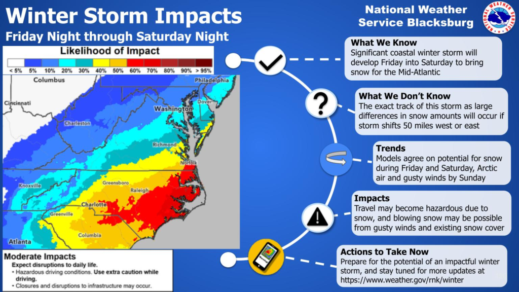
Current forecast guidance indicates that snow is possible from Friday night through Saturday night, particularly across central and eastern Virginia. However, meteorologists caution that the exact track of the storm remains uncertain, and even small shifts east or west could result in large differences in snowfall totals and where the heaviest snow occurs.
If the storm tracks close enough to the coast, accumulating snow could impact travel and daily activities. Gusty winds may also develop as colder air moves into the region, potentially leading to reduced visibility in blowing snow where accumulation occurs. Hazardous driving conditions and disruptions to infrastructure are possible if snow becomes widespread.
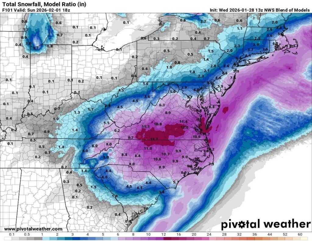
Currently, the National Weather Service National Blend of Models pictured above shows measurable snowfall for all of Virginia this weekend. This can and will change.
At this time, forecasters have moderate confidence that some form of winter weather will affect the Mid-Atlantic, but low confidence in specific snowfall amounts or impact zones within Virginia. Additional forecast refinement is expected as newer data becomes available over the next couple of days.
Residents across Virginia are encouraged to stay informed by monitoring forecast updates and be prepared for possible winter weather impacts as the weekend approaches.


