


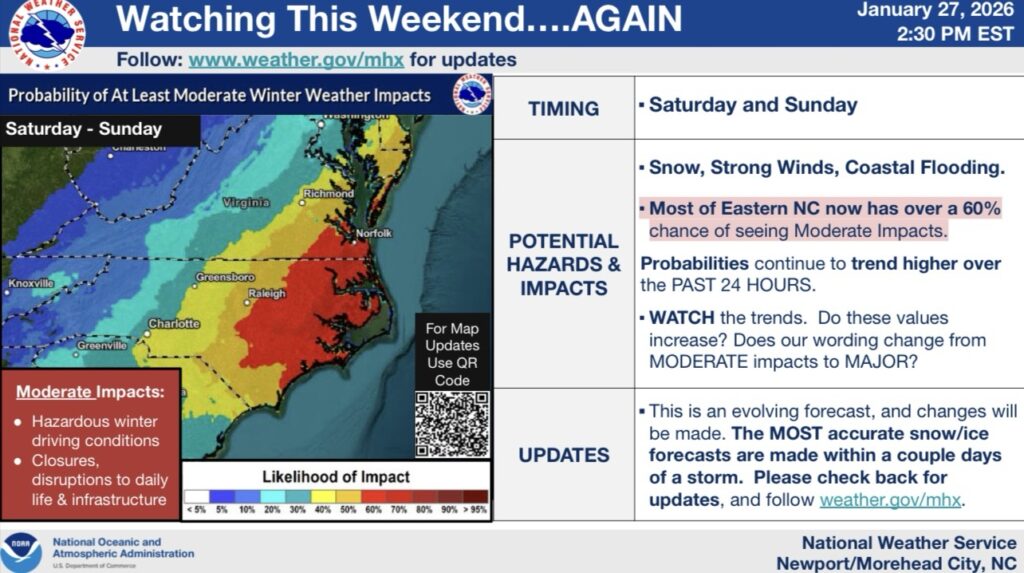
KENTUCKY — Weather officials are monitoring a developing storm system that could influence weather conditions in Kentucky this weekend, though uncertainty remains regarding the extent of any winter weather impacts.
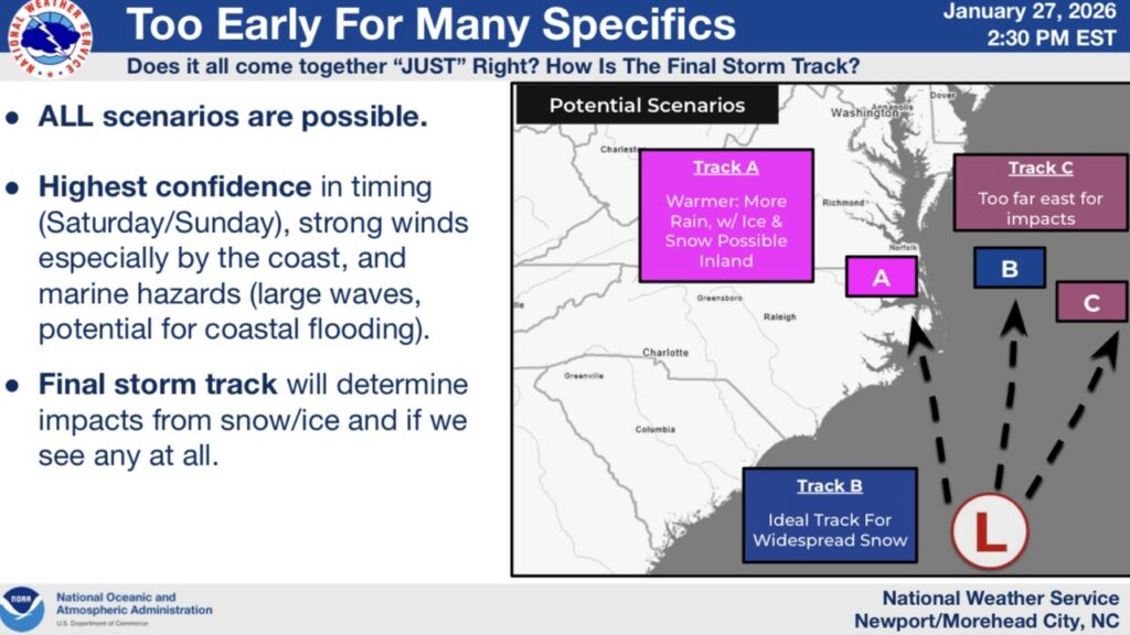
According to the National Weather Service, the system is expected to move through the region Saturday and Sunday. Meteorologists say confidence is highest in the timing of the system and the potential for strong winds, while confidence remains lower on whether snow or ice will affect Kentucky.
Forecast models indicate multiple possible storm tracks. One scenario could bring warmer air into the region, resulting mainly in rain. Another scenario could allow colder air to remain in place, creating the potential for snow or mixed precipitation, especially in northern or higher-elevation areas. A third scenario would shift the storm farther east, limiting impacts across the state.
Forecasters emphasized that the final track of the system will determine whether Kentucky experiences winter weather impacts at all. They noted that snowfall and ice accumulation forecasts typically become more reliable within a few days of a storm.
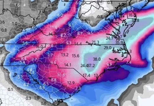
Currently, the GFS model pictured above is being the most generous with snow totals showing several inches of snow for southeastern Kentucky.
It’s important to note that this is just a model run and not a forecast. Things can and will change.
Residents are encouraged to monitor weather updates as the weekend approaches and remain prepared for changing conditions.


