


ILLINOIS — Weather models continue to indicate the potential for measurable snowfall across much of Illinois from November 29 through the early part of the first week of December.
The latest run of the GFS model suggests snow could begin on Saturday, November 28, with periods of snowfall continuing intermittently through Tuesday, December 2.
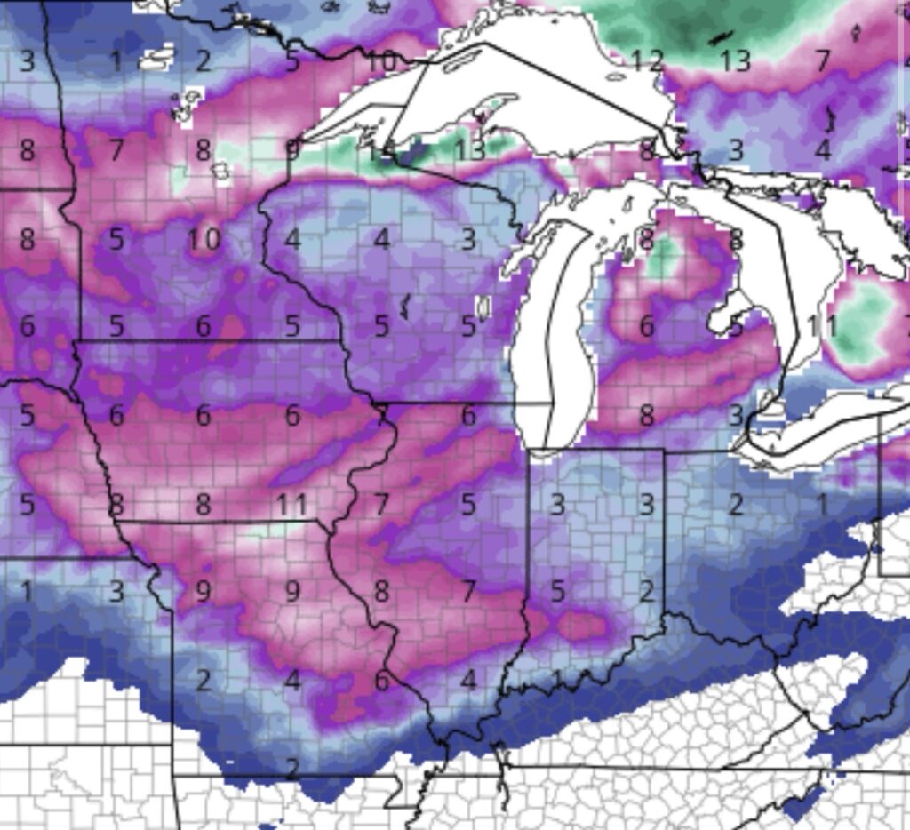
According to current projections, western Illinois may see the highest accumulations, with 6 to 8 inches possible in and around Quincy, Galesburg, Springfield, Peoria, Rockford and Effingham. Much of eastern Illinois is projected to receive 3 to 6 inches, while southern Illinois is expected to see between 2 and 3 inches.
Forecast highs from November 29 through December 4 are expected to average in the 40s, with overnight lows ranging from the upper 20s to low 30s.
Meteorologists caution that these projections may change as the forecast period approaches. The totals reflect what the GFS model was showing as of 6:30 p.m. Sunday.
Your latest forecast may be viewed here.


