


WISCONSIN — Severe thunderstorm watches remain in effect for parts of northern Wisconsin Monday evening as forecasters warn that damaging storms will continue to develop across the Upper Midwest through tonight.
According to the National Weather Service, Ashland, Bayfield and Iron counties remain under Severe Thunderstorm Watch 414 until 6 p.m. CDT Monday. The watch also includes adjacent Lake Superior waters, including Chequamegon Bay, the Apostle Islands area and nearshore waters from Port Wing to Saxon Harbor.
A second watch, Severe Thunderstorm Watch 416, is in effect until 10 p.m. CDT Monday for Vilas County.
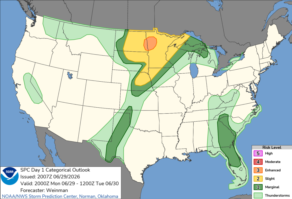
The Storm Prediction Center says severe thunderstorms are expected today across the Dakotas, Upper Midwest and Middle Missouri Valley, with damaging winds, large hail and a few tornadoes possible through tonight.
The latest outlook places much of northern Wisconsin under a Level 2 of 5 (Slight Risk) for severe weather Monday, with a Level 1 of 5 (Marginal Risk) extending across additional portions of the state.
Forecasters say storms capable of producing damaging wind gusts and large hail are the primary concern. While the greatest tornado threat is focused farther west across eastern North Dakota and northwestern Minnesota, an isolated tornado cannot be ruled out elsewhere in the Upper Midwest.
Residents in affected areas are urged to monitor the latest forecasts, have multiple ways to receive weather warnings, and be prepared to take shelter quickly if severe thunderstorm or tornado warnings are issued.


