


MICHIGAN — A Severe Thunderstorm Watch is in effect for portions of Michigan’s Upper Peninsula through 10 p.m. CDT Monday, while forecasters warn that additional severe thunderstorms are possible across parts of the state on Tuesday.
According to the National Weather Service’s Storm Prediction Center, Baraga, Dickinson, Gogebic, Houghton, Iron, Keweenaw, Marquette and Ontonagon counties are included in Severe Thunderstorm Watch 416 until 10 p.m. CDT Monday.
The watch also includes portions of Lake Superior adjacent to the Upper Peninsula, including waters from Saxon Harbor, Wisconsin, to Marquette, Michigan, as well as areas surrounding Isle Royale National Park.
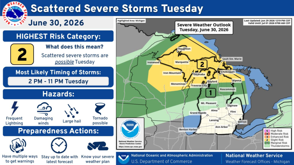
Looking ahead to Tuesday, the National Weather Service places much of the Upper Peninsula and portions of northern Lower Michigan under a Level 2 of 5 (Slight Risk) for severe weather, with a surrounding Level 1 of 5 (Marginal Risk) covering additional areas.
Forecasters say the greatest threat for severe storms is expected between 2 p.m. and 11 p.m. Tuesday.
Potential hazards include:
- Frequent lightning
- Damaging wind gusts
- Large hail
- A few possible tornadoes
The National Weather Service advises residents to have multiple ways to receive weather warnings, monitor the latest forecasts throughout the day, and review severe weather safety plans before storms develop.


