


WISCONSIN — The National Weather Service’s Storm Prediction Center is warning of a tornado threat across parts of Wisconsin as severe storms are expected to develop Friday.
In its Day 1 Convective Outlook issued Friday morning, forecasters placed portions of the Upper Midwest, including Wisconsin, under an enhanced risk for severe thunderstorms. The outlook indicates that conditions will be favorable for the development of strong storms capable of producing tornadoes.
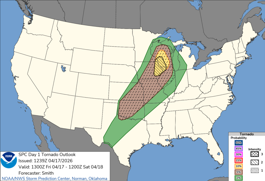
Meteorologists say a warm and increasingly unstable air mass, combined with strong wind shear, will support the formation of supercell thunderstorms during the afternoon and evening hours. These storms could produce large to giant hail, damaging winds, and tornadoes.
According to the forecast discussion, discrete supercells may develop across parts of central and northern Wisconsin, particularly near a low-pressure system moving through the region. All severe weather hazards are possible with these storms, including the potential for an intense tornado.
As the system progresses into the evening, storms are expected to organize into a line moving eastward. While damaging wind gusts may become the primary threat, the tornado risk could continue with embedded circulations within the line.
Residents across Wisconsin are urged to stay alert to changing weather conditions, have multiple ways to receive warnings, and be prepared to take shelter quickly if severe weather develops.


