


OHIO — A strong cold front moving through the region Monday could cause rain to change to snow across portions of Ohio as temperatures rapidly fall Monday evening into the overnight hours.
According to the National Weather Service in Charleston, precipitation is expected to begin as rain before colder air arrives behind the front. As temperatures drop, the rain may transition to snow across the region Monday night.
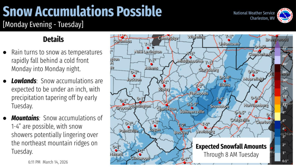
In lower elevation areas, including much of southern and central Ohio, snow accumulations are expected to remain light. Forecasters say totals will likely stay under one inch, with precipitation gradually tapering off by early Tuesday morning.
Higher elevations in the region could see somewhat greater snowfall totals. In mountainous and ridge-top areas near the Ohio Valley and surrounding Appalachian terrain, snow accumulations of 1 to 4 inches are possible. Snow showers may also linger over the northeast-facing mountain ridges into Tuesday.
The system is expected to move out of the region by early Tuesday, bringing an end to the precipitation as colder air settles in behind the front. Motorists traveling late Monday night into Tuesday morning should remain alert for changing road conditions as temperatures fall and any lingering moisture freezes.


