


OKLAHOMA — Severe weather expected across parts of the southern Plains this week could lead to school disruptions in portions of Oklahoma, particularly if storms cause power outages, flooded roadways, or fallen trees blocking transportation routes.
According to the NOAA Storm Prediction Center, an enhanced risk of severe thunderstorms is forecast across parts of Oklahoma as a storm system moves across the southern Plains. Meteorologists say thunderstorms could develop Tuesday afternoon and evening along a dryline stretching across western portions of the state.
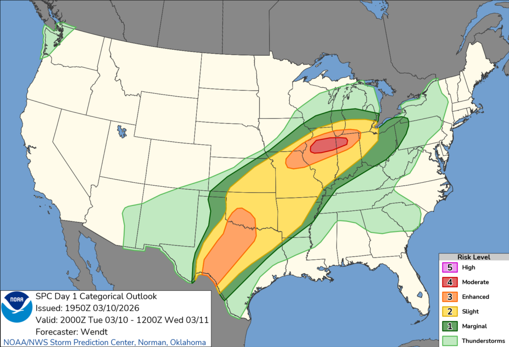
Warm, moist air moving north from the Gulf of Mexico combined with strong winds higher in the atmosphere is expected to create favorable conditions for organized thunderstorms. Some storms could develop into supercells capable of producing very large hail, damaging wind gusts, and isolated tornadoes.
Forecasters say storms may initially produce large hail before evolving into lines of thunderstorms that could spread eastward across the state through the evening and overnight hours. These lines of storms could bring widespread wind damage capable of downing trees and power lines.
If power outages occur, some school districts may delay or cancel classes until electricity is restored and school buildings can safely operate. Downed trees and storm debris can also block roads, creating hazardous conditions for school buses and emergency vehicles.
Heavy rainfall may accompany the storms as well. In some areas, water could cover low-lying roads or cause localized flooding, which may make bus routes unsafe for students.
Even after the storms move out, cleanup operations and lingering power outages could affect school schedules in some communities. School officials typically evaluate road conditions, power availability, and storm damage early in the morning before announcing delays or closures. Parents and students are encouraged to monitor local alerts and district announcements as the storm system moves through the region.


