


ILLINOIS — Severe thunderstorms capable of producing tornadoes and large hail are possible across parts of Illinois Friday, according to the National Weather Service’s Storm Prediction Center.
Forecasters have placed western and north-central Illinois under an “enhanced risk” for severe weather, including areas near Quincy and Macomb. These areas are expected to have the greatest potential for more intense storms.
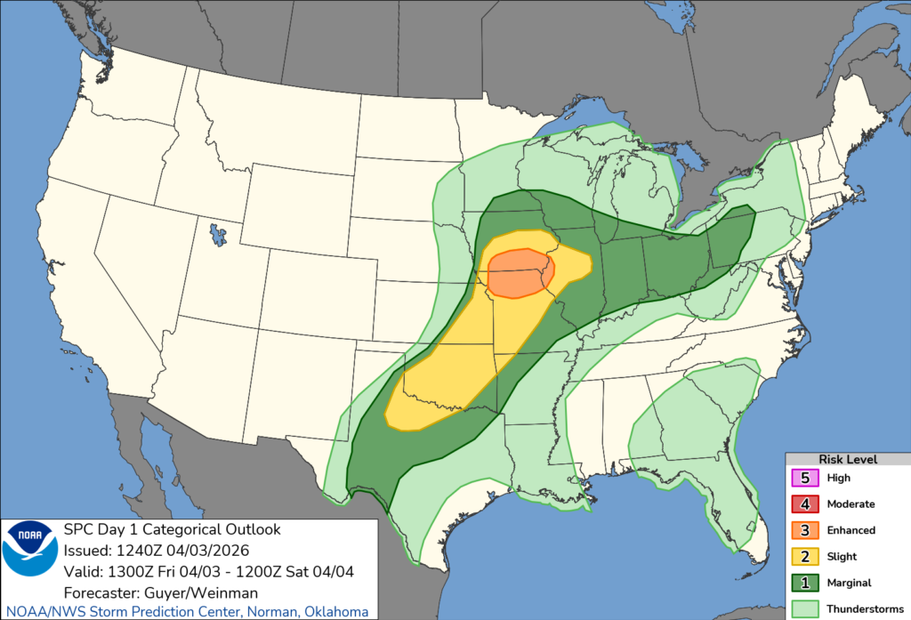
A broader portion of the state, including central Illinois and areas near Springfield and Peoria, is under a “slight risk,” meaning scattered severe storms are possible.
According to the Storm Prediction Center, a few tornadoes and isolated very large hail may develop late Friday afternoon into the evening, particularly in western and north-central Illinois as storms strengthen.
Meteorologists say atmospheric conditions will support the development of supercell thunderstorms, which are capable of producing tornadoes. As the evening progresses, storms are expected to organize into a larger line, increasing the threat of damaging winds across much of the state.
Forecasters also noted that multiple rounds of storms are possible in some areas, which could prolong the severe weather threat into the overnight hours.
Residents are urged to monitor weather updates and be prepared to take shelter if warnings are issued.


