


TENNESSEE — Models continue to show the possibility of winter weather across Tennessee this weekend as of Monday afternoon.
Both the Euro and GFS models are showing a winter storm moving in from the southwest and to the east coast affecting Tennessee Saturday January 25, and Sunday, January 26.
It’s important to note that these are model runs and things can and will change.
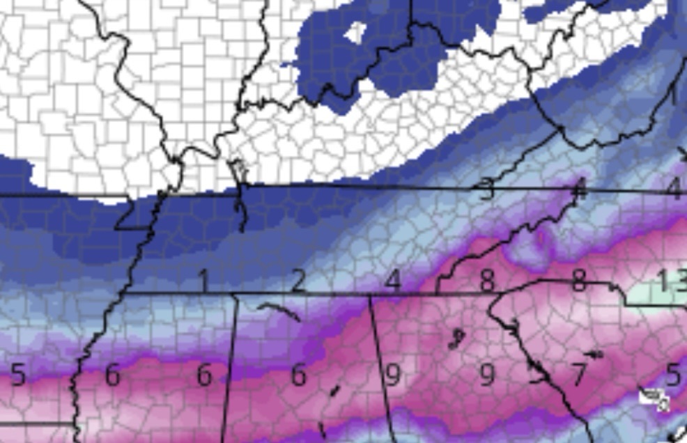
When it comes to snow totals, the GFS is showing a more southern track which means less snow for the bulk of Tennessee.
Currently, the GFS is showing a few inches of snow possible for most of Tennessee with the eastern part of the state receiving the most with up to 6 to 8 inches in some places.
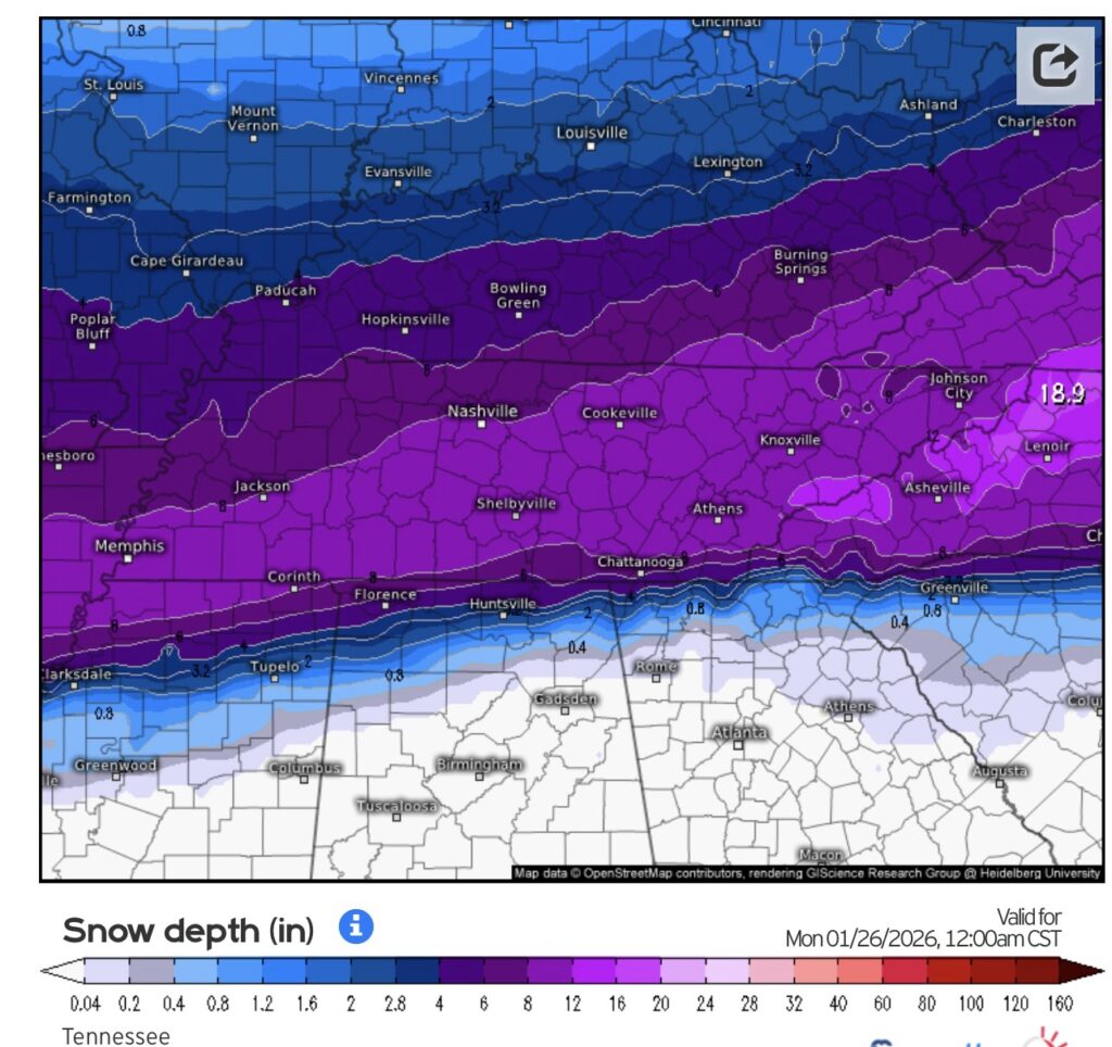
The EURO is currently showing a more northern track which means more snow for most of the state with over a foot possible in many places.
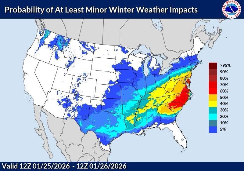
The National Weather Service is currently predicting at least a decent chance of minor winter weather impacts in Tennessee this weekend.
Your latest forecast may be viewed here.


