


OHIO — Dangerously cold weather is expected to settle across Ohio early next week, raising concerns about potential school delays or closures as wind chills plunge well below zero, according to the National Weather Service.
Forecasters with the National Weather Service offices in Wilmington and Cleveland say an arctic air mass will move into the Ohio Valley beginning Monday and persist through midweek. Gusty winds are expected to develop Monday, with wind speeds of 25 to 30 mph combining with frigid temperatures to produce wind chills near and below zero across much of the state.
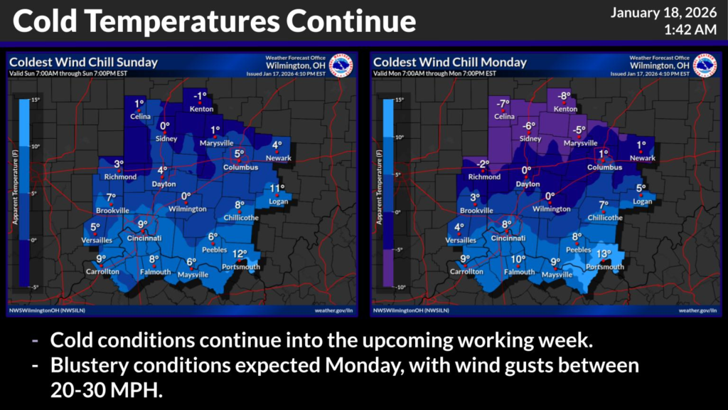
The coldest conditions are expected Monday night into Tuesday, when wind chill values could range from minus 10 to minus 20 degrees, particularly in northern and central Ohio. Weather graphics from the National Weather Service indicate subzero wind chills in many communities, including portions of western, central and northern Ohio, with only limited improvement during daylight hours.
These extreme conditions could impact school operations, especially during morning bus routes when students are exposed to the cold for extended periods. Districts may consider delays, remote learning days, or closures if wind chills reach levels that pose a risk of frostbite or hypothermia.
In addition to the cold, several fast-moving “clipper” systems are expected to pass through the region during the middle of the week. These systems could bring periods of widespread light snow, which may further complicate travel and school transportation schedules.
Cold conditions are expected to continue into the upcoming workweek, with only gradual moderation later in the week. Parents and students are encouraged to monitor announcements from local school districts and stay informed about changing weather conditions. Officials also urge residents to dress in layers, limit time outdoors, and take precautions to protect children, pets, and vehicles during the prolonged cold snap.


