


SOUTH CAROLINA — Forecasters are closely monitoring the potential for a winter storm to affect South Carolina this weekend, with snow identified as the primary threat across much of the state.
While confidence is increasing that wintry weather could occur, uncertainty remains regarding the exact track of the storm system, which will play a key role in determining snowfall totals and overall impacts.
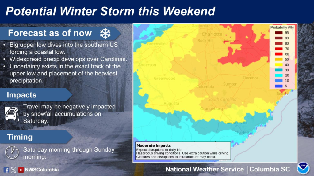
According to the National Weather Service, a large upper-level low pressure system is expected to dive into the southern United States, helping to force the development of a coastal low. As this system evolves, widespread precipitation is expected to develop across the Carolinas. However, small changes in the storm’s path could significantly affect where the heaviest precipitation falls and how much snow accumulates.
Current forecasts suggest that portions of South Carolina could experience snowfall beginning Saturday morning and continuing into Sunday morning. Travel impacts are possible, particularly if snow accumulates on roadways. Forecasters note that hazardous driving conditions could develop, and disruptions to daily activities may occur in areas that see measurable snow.
At this time, confidence in exact snowfall amounts remains limited. Some forecast scenarios indicate moderate impacts, including slippery roads and potential delays, while other outcomes would result in lighter snowfall with more limited effects. The uncertainty is typical several days in advance of a winter storm, especially for systems dependent on precise temperature and track details.
The current National Weather Service National Blend of Models, pictured above, shows several inches of snow for South Carolina, but things are expected to change.
Meteorologists emphasize that residents should continue to closely monitor forecast updates as newer data becomes available. Additional clarity is expected as the weekend approaches, and updates will be issued if watches, advisories, or warnings become necessary.


