


WISCONSIN — Severe storms and ongoing flooding concerns are expected across parts of Wisconsin on Monday, according to the National Weather Service in Green Bay.
Forecasters say there is an enhanced risk for severe thunderstorms late Monday afternoon and evening, with the potential for large hail, damaging winds and a few tornadoes.
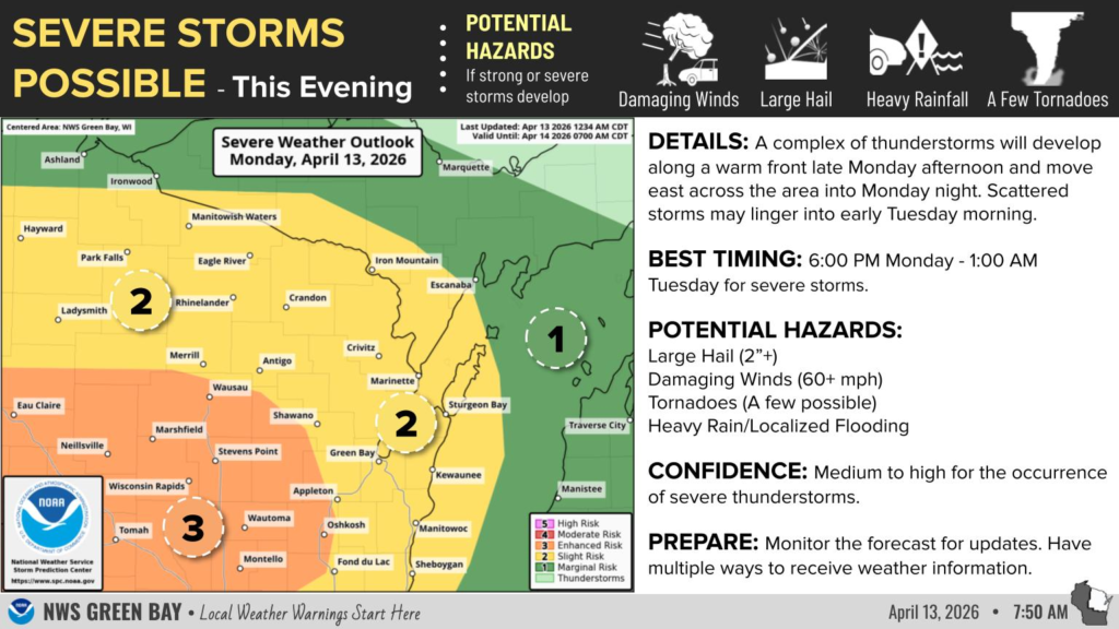
The storms could produce hail up to 2 inches in diameter and wind gusts exceeding 60 miles per hour. Heavy rainfall is also expected, which may lead to localized flooding in some areas.
The strongest storms are anticipated to develop during the late afternoon and continue into the evening hours before diminishing around midnight.
In addition to the severe weather threat, multiple rivers across the state remain under flood warnings due to recent rainfall and additional precipitation expected in the coming days.
The National Weather Service reports that the Menominee, Oconto, Wisconsin, Pine and Embarrass rivers are all experiencing elevated water levels, with some areas possibly reaching moderate flood stage. Flooding may also impact low-lying and poorly drained areas.
Forecasters warn that repeated rounds of thunderstorms could bring excessive rainfall, particularly across central and east-central Wisconsin, increasing the risk of further flooding.
Another round of severe weather is possible Tuesday afternoon and evening, with damaging winds, large hail and torrential rainfall again posing the primary threats.
Residents are urged to monitor forecasts closely and ensure they have multiple ways to receive weather warnings.


