


OHIO — Winter weather returns across much of Ohio beginning Wednesday, with rain changing to snow and gusty winds potentially affecting travel conditions through early Thursday, according to the National Weather Service Wilmington Ohio and National Weather Service Cleveland.
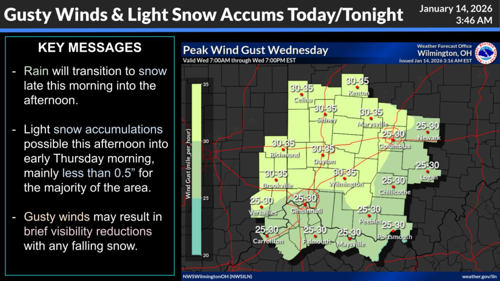
Forecasters said rain will transition to snow later Wednesday morning into the afternoon. Light snow accumulations are expected this afternoon into early Thursday morning, with most locations seeing less than 0.5 inches of snow. Winds could gust strongly enough at times to briefly reduce visibility with any falling snow, officials said.
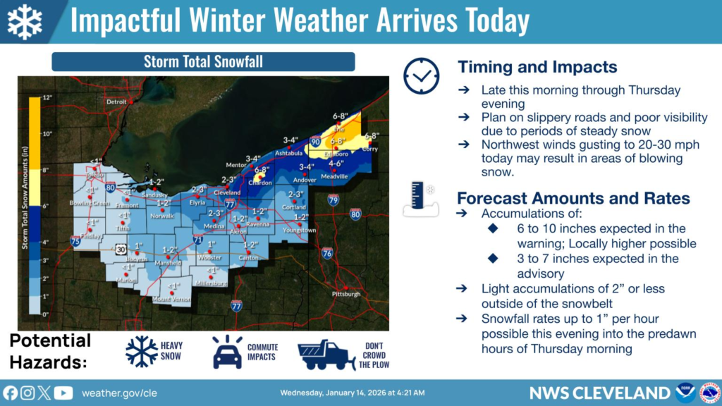
Further north and east, heavier snow is possible as lake-effect bands develop later Wednesday evening into Thursday. Snowbelt areas around northeastern Ohio could see higher totals, with several inches expected in those counties.
According to NWS-Cleveland projections, some snowbelt locations may receive 6 to 10 inches of snow where lake-effect snow persists, while surrounding areas could pick up 3 to 7 inches through Thursday. Snowfall rates up to an inch per hour are possible overnight into the predawn hours Thursday, the forecast shows.
In addition to accumulating snow, northwest winds gusting 20-30 mph or higher may create blowing snow and make travel difficult. Both weather offices caution that roads could become slippery and visibility poor, especially during the evening commute Wednesday and again Thursday morning.
Drivers are urged to stay weather aware, allow extra travel time, and check for updated road conditions before heading out. The National Weather Service continues to monitor evolving conditions as winter weather impacts spread across the region.


