


VIRGINIA — The National Weather Service says confidence is growing that another round of accumulating snow will move into Virginia early Monday, bringing light but potentially travel-impacting snowfall to parts of the region.
The developing system is expected to affect much of the lower Mid-Atlantic through Monday evening.
Forecasters project that 1 to 2 inches of snow will fall across the mountains of southwest and western Virginia, especially in areas south of Highway 460, including communities near Blacksburg, Floyd, Hillsville, Christiansburg, and the higher elevations toward the North Carolina border.
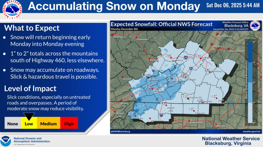
Locations farther north and east — such as Roanoke, Lynchburg, Lexington, and into south-central Virginia — are expected to see lower totals, generally an inch or less.
The National Weather Service warns that snow may accumulate on roadways, particularly during the morning hours when temperatures are colder.
Even with relatively light totals, slick and hazardous travel conditions are possible on untreated roads and overpasses. A brief period of moderate snowfall could also reduce visibility in some areas.
Drivers across Virginia are encouraged to use caution Monday morning and allow extra time for travel as conditions may deteriorate quickly in spots. The storm is expected to taper off later in the day as temperatures gradually rise.


