


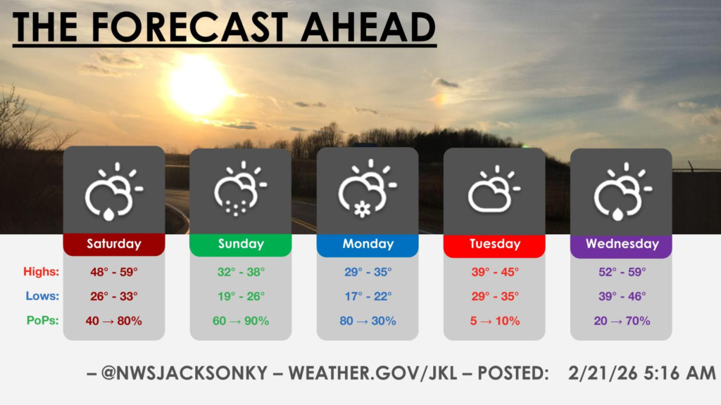
KENTUCKY — A Winter Weather Advisory has been issued for several counties in eastern Kentucky as snow is expected to move into the region late Sunday morning and continue through Monday evening.
The National Weather Service announced the advisory will be in effect from 11 a.m. Sunday until 6 p.m. EST Monday for Harlan, Floyd, Knott, Perry, Letcher, Martin and Pike counties.
Communities including Hazard, Pikeville, Prestonsburg, Whitesburg, Harlan, Inez, Jenkins, South Williamson, Hindman, Wheelwright, Coal Run, Cumberland, Pippa Passes and Elkhorn City are expected to see accumulating snowfall.
Forecasters say most areas will receive between 1 and 2 inches of snow. However, higher elevations near the Virginia border could see totals of up to 5 inches, particularly in mountainous terrain.
Winds are expected to gust between 15 and 25 miles per hour. Combined with falling snow, those gusts could lead to brief reductions in visibility during the daytime hours Sunday and Monday.
Roads, especially bridges and overpasses, are likely to become slick. The hazardous conditions could impact both the Monday morning and evening commutes across northeast and southeast Kentucky.
Drivers are urged to slow down and use caution while traveling. Up-to-date road conditions across Kentucky are available at goky.ky.gov.


