


OHIO — The latest run of the Euro weather model is showing the possibility of measurable snowfall in Ohio Sunday into Monday.
As of Friday evening, the Euro is showing the possibility of a winter weather system moving through Ohio Sunday and lasting into Monday.
According to the model run, central Ohio from the west to east looks to see the best chance for measurable snowfall from 1-3 inches possible.
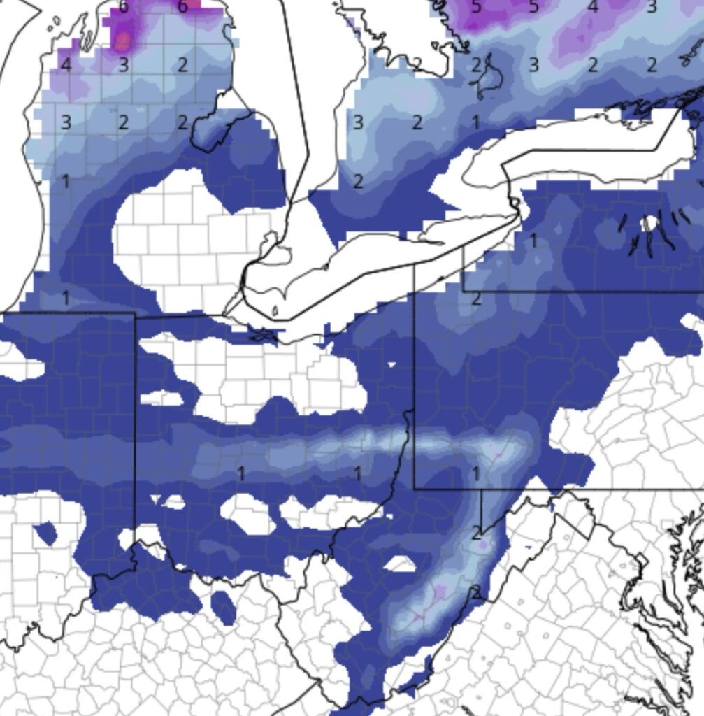
Northern Ohio looks to see maybe a dusting with an inch possible around Cleveland and Youngstown.
Southern Ohio will see the same, around a dusting to an inch, according to the latest model run.
It’s important to note that this is a model run and things can change. Updates will be provided as they come in.
Sunday will reach the upper 30s with lows in the 20s while Monday will see highs in the 40s with lows in the mid 20s.
Your latest forecast may be viewed here.


