


TENNESSEE — Meteorologists are tracking a potential winter storm this weekend that could bring accumulating snow across much of Tennessee, from the western part of the state near Memphis through Middle and East Tennessee. While key details — including exact snow totals and timing — remain uncertain, confidence is rising that snow will accompany this system at some point between Friday night and Sunday morning.
FORECAST OUTLOOK: SNOW ON THE WAY?
Weather forecasts from the National Weather Service and regional meteorologists show that a strong winter system is likely to move across Tennessee this weekend, with temperatures dropping below freezing late Friday and remaining cold into early next week.
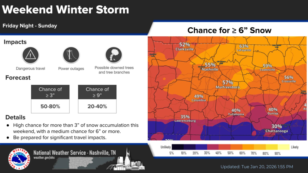
According to the National Weather Service in Nashville, there is increasing confidence in at least several inches of snow for much of Middle Tennessee, with the probability of measurable snowfall (3 inches or more) forecast to be moderate, and appreciable snow accumulations possible if the storm’s track and precipitation type favor cold conditions.
The timing of the storm is expected to span late Friday night through Sunday, but forecasters emphasize that exact precipitation onset, intensity and amounts are still uncertain and likely to change as the storm gets closer.
REGIONAL VARIATIONS
- Middle Tennessee: Forecast confidence is growing that snow will fall in the Middle Tennessee region this weekend. Meteorologists have noted that the area may meet criteria for a winter storm warning if snow totals approach several inches, though specifics remain unclear.
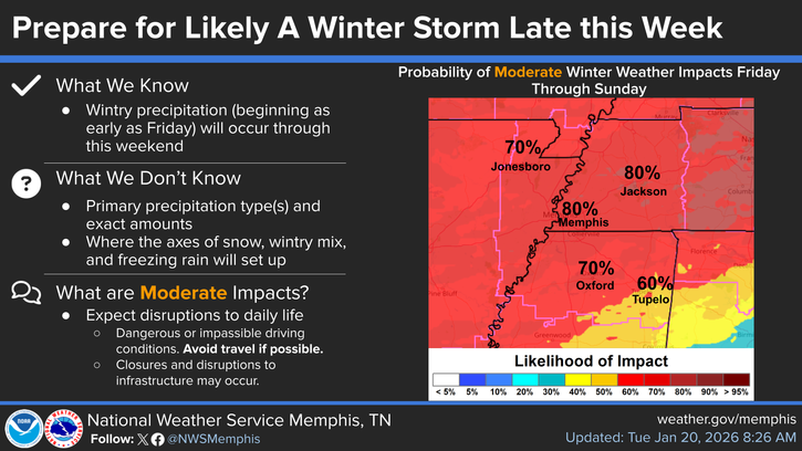
- West Tennessee (including Memphis area): Models suggest snow may start Friday night and continue intermittently through the weekend, with accumulating snow likely if cold air remains entrenched.
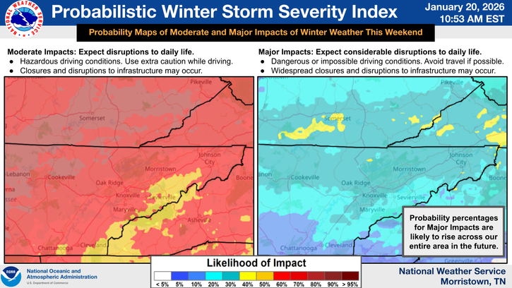
- East Tennessee: Winter weather may impact East Tennessee as well, with forecasts indicating that heavy frozen precipitation — including snow — is increasingly likely, though where snow transitions to ice remains a forecast challenge.
Forecasters also note that sleet or freezing rain could mix with snow in some areas, which could reduce total snow accumulation but still contribute to hazardous conditions on roadways.
DRIVING AND SAFETY IMPACTS
If accumulating snow occurs, even moderate amounts — a few inches or more — could cause hazardous travel conditions across the state. Snow falling on cold pavement may stick quickly, and sub-freezing temperatures could persist into early next week, keeping snow on roads longer than usual.
Residents should prepare for slick roads, reduced visibility and slower travel, especially on untreated secondary and rural roads where snow and ice tend to linger. Emergency preparedness officials also remind drivers to:
- Carry winter driving supplies such as blankets, food and water.
- Allow extra travel time or postpone non-essential trips.
- Monitor local forecasts as this developing situation evolves.
FORECAST UNCERTAINTY AND NEXT STEPS
At this stage, meteorologists stress that precise snow totals and impacts are still being refined. These details hinge on the storm’s path, the depth of cold air near the surface and the timing of precipitation onset across the state.
Weather forecast offices statewide will continue to update winter storm watches and warnings as confidence increases later in the week. Residents are encouraged to check the latest National Weather Service forecasts and local weather agency announcements in the coming days as this potential winter event approaches.


