


KENTUCKY — The National Weather Service is warning residents in several eastern Kentucky counties to prepare for light snow and slippery travel conditions beginning Wednesday evening and continuing into Thursday morning.
A Winter Weather Advisory is in effect for Knox, Bell, Floyd, Knott, Perry, Clay, Leslie, and Pike Counties, including the cities of Manchester, Hazard, Pikeville, Pineville, Prestonsburg, Barbourville, Middlesboro, Hyden, Hindman, Coal Run, Elkhorn City, and Pippa Passes.
Snow showers are expected to develop after 7 p.m. Wednesday and continue through 10 a.m. Thursday.
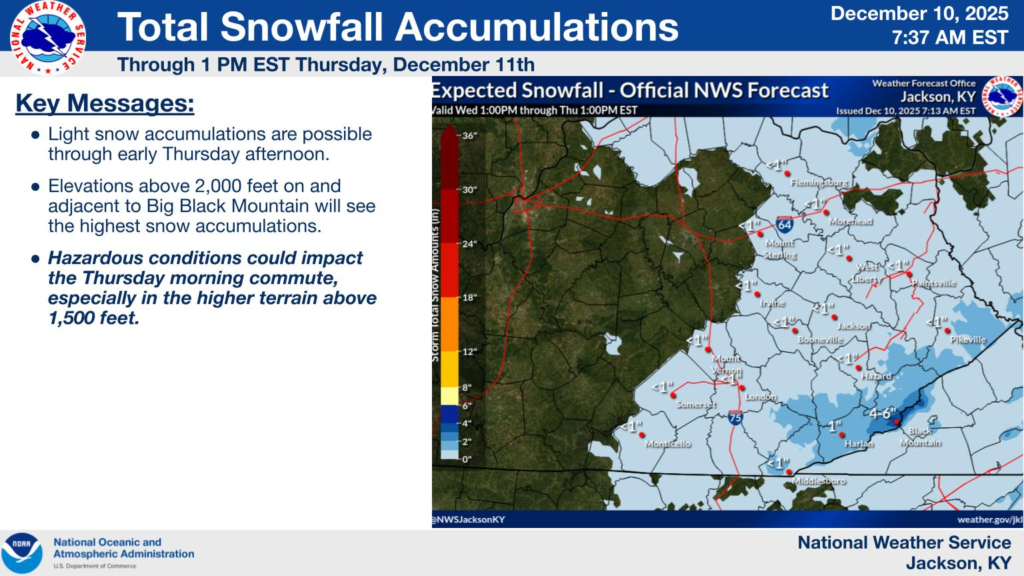
At elevations above 1,500 feet, 1 to 2 inches of snow are forecast, while communities in lower valleys will likely see an inch or less. Drivers should anticipate slick roads, especially on mountain passes and higher terrain, where travel impacts may be greatest during the Thursday morning commute.
A separate advisory is also in place for Harlan and Letcher Counties, including Harlan, Cumberland, Jenkins, and Whitesburg, beginning at 3 p.m. Wednesday.
Snow totals of 1 to 2 inches are expected, but areas above 2,000 feet near Big Black Mountain could receive 2 to 4 inches. Forecasters note that precipitation may begin as rain in the afternoon before changing to snow, with snow reaching the valley floors by around 8 p.m.
Motorists across the region are urged to slow down, allow extra travel time, and monitor changing road conditions. Kentucky highway updates are available at goky.ky.gov, and officials stress using caution during both the evening hours and Thursday morning’s commute. The combination of colder temperatures, wet roads, and light accumulation could create hazardous travel even where snowfall totals remain modest.


