


TEXAS — Parts of Texas are facing an increased risk of flash flooding and severe weather through Sunday night, according to the National Weather Service.
Forecasters in the Fort Worth/Dallas region report that the flash flood threat has intensified across portions of Central Texas and the Brazos Valley. While not all areas are expected to see rainfall, locations that do experience thunderstorms could receive quick rainfall totals of 1 to 3 inches.
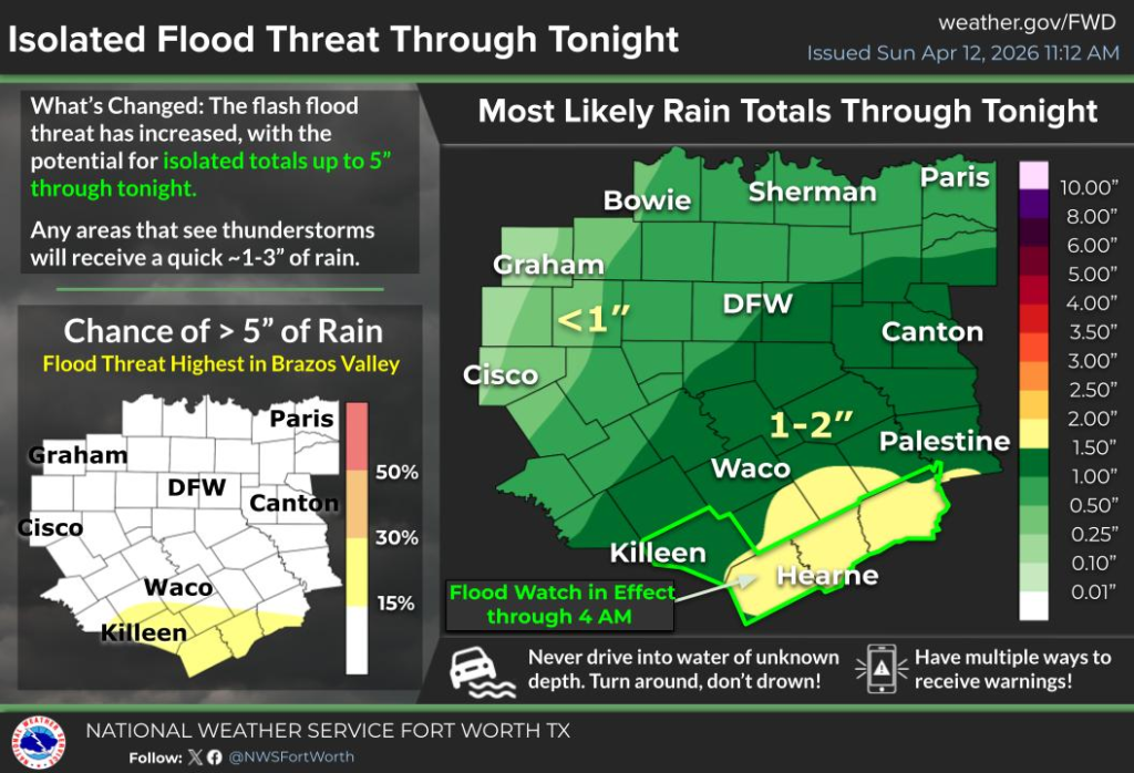
Meteorologists say there is about a 15% chance that some areas, particularly in the Brazos Valley, could see more than 5 inches of rain due to repeated thunderstorms moving over the same locations. A Flood Watch remains in effect through early Monday morning.
In addition to heavy rain, storms are expected to bring the potential for large hail, damaging winds, and isolated flash flooding. Severe weather risks are expected to continue into the week, with additional rounds of storms possible through Wednesday.
Temperatures across the region are expected to remain warm, with highs reaching into the 80s and overnight lows in the mid to upper 60s.
Officials are urging residents to remain weather-aware and avoid driving through flooded roadways, reminding motorists to “turn around, don’t drown.”


