


WEST VIRGINIA — The National Weather Service in Charleston is warning of a significant change in weather conditions as a strong cold front moves through the region late Sunday into early Tuesday.
According to forecasters, temperatures surged Sunday ahead of the front, but conditions are expected to deteriorate rapidly Sunday night as the system passes through.
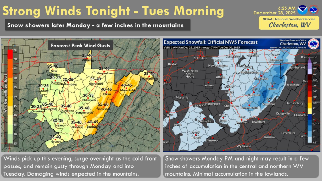
Gusty winds are forecast across the lowlands, while the mountains of central and northern West Virginia could experience potentially damaging wind gusts late Sunday night through Tuesday morning. Peak wind gusts in the mountains may reach 50 to 60 mph, while lower elevations could see gusts in the 30 to 40 mph range.
As colder air moves in, temperatures will steadily fall throughout Monday. Any lingering rain showers are expected to transition to snow showers by Monday afternoon.
Snow accumulation is expected to remain minimal in the lowlands due to initially warm ground temperatures, with little to no measurable snow anticipated. However, higher elevations in the central and northern West Virginia mountains could see one to three inches of snow, with localized areas potentially receiving slightly higher amounts in the highest terrain.
Snow showers may continue into Monday night before tapering off. The National Weather Service advises residents, particularly in mountain communities, to remain alert for hazardous travel conditions and the possibility of power outages due to strong winds.


