


KENTUCKY — Forecasters say a series of passing weather systems could bring light snow accumulations to much of eastern Kentucky from Friday through Saturday night, along with another surge of colder air.
According to the National Weather Service, the region is expected to see periods of light snowfall as multiple systems move through the area. Snowfall amounts are expected to be generally light, but accumulations may occur across a wide portion of eastern Kentucky, particularly in higher elevations.
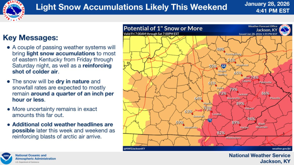
Meteorologists note that the snow is expected to be dry in nature, with snowfall rates remaining relatively low, generally around a quarter of an inch per hour or less. While this should limit rapid accumulation, slick conditions could still develop on untreated roads, bridges, and overpasses, especially during overnight and early morning hours.
Forecast guidance shows varying probabilities for at least one inch of snow across eastern Kentucky, with higher chances in southeastern counties, including areas near Hazard, Harlan, Pikeville, and surrounding communities. However, forecasters emphasize that uncertainty remains regarding exact snowfall totals this far in advance.
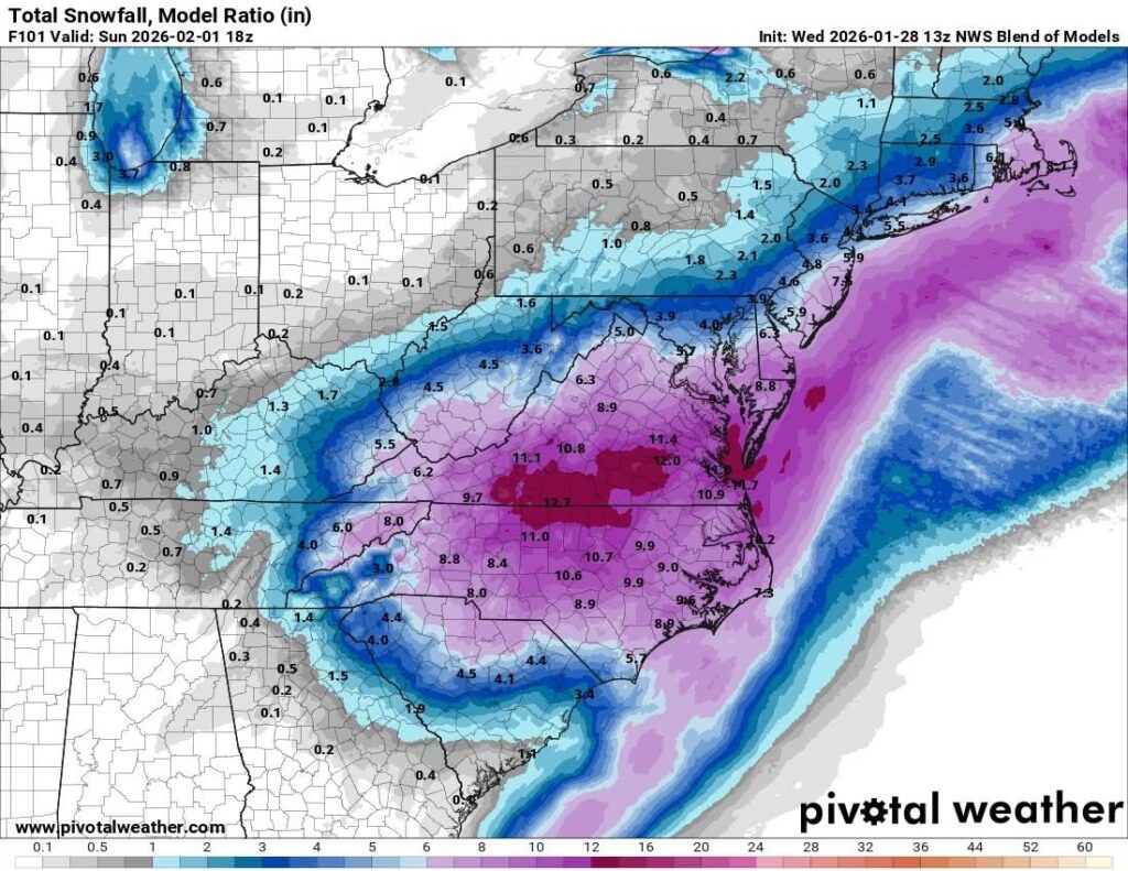
Currently, the National Weather Service National Blend of Models, pictured above, shows measurable snowfall in eastern Kentucky this weekend.
In addition to snow, a reinforcing blast of cold Arctic air is expected to move into the region during and after the system, keeping temperatures below freezing and allowing snow and ice to linger. The National Weather Service says additional cold weather advisories or headlines may be issued later in the week and over the weekend as colder air settles in.
Residents across eastern Kentucky are encouraged to stay updated on the latest forecasts and be prepared for possible winter travel impacts as conditions develop.


